Table of Contents
List of Tables
3.1.1 Introduction
This section provides information on the ENVISAT data acquired during the validation project. The Canadian Ice Service (CIS) received processed data from the Canada Centre for Remote Sensing (CCRS) and then ingested on local systems into the ERDAS Imagine native georeferenced format (IMG). A total of 8 scenes were acquired over the study area during the project.
Back to Table of Contents3.1.2 Sensor Description
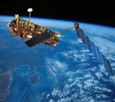
The ENVISAT satellite was developed by the European Space Agency to provide measurement of the atmosphere, oceans, land and ice. The satellite was launched in March 2002 equipped with two radar instruments, three spectrometers of different types and measurement characteristics, two different radiometers (broad and narrow band), the first high-resolution spaceborne interferometer for long-term observation, and two instruments for range measurements. Of particular interest is the Advanced Synthetic Aperture Radar (ASAR) which has the capability of acquiring dual channel data. In alternating polarization mode (AP Mode), it provides one of three different channel combinations:
- VV and HH
- HH and HV
- VV and VH
Two alternating polarization data sets were acquired in support of this project - one in VV/HH polarization and the other in the VV/VH polarization. In Table 3.1.1 below the SAR characteristics of the satellite are listed.
| SAR Characteristics | ||
|---|---|---|
| Wide Swath | Alt/Cross Pol | |
| Frequency / Wavelength | 5.331 Ghz | 5.331 Ghz |
| Pulse Repeat Freq. | 1650 to 2100 Hz | 1650 to 2100 Hz |
| Chirp Bandwidth | Up to 16 Mhz | Up to 16 Mhz |
| Data Rate | <= 100 Mbit/s | <= 100 Mbit/s |
| Antenna Size | 10m x 1.3m | 10m x 1.3m |
| Antenna Polarization | VV or HH | VV/HH, VV/VH, HH/HV |
There are numerous ASAR data products and imaging modes. For the purposes of this project, only the information for Alternating Polarisation Precision Imagery is shown below in Table 3.1.2:
| Imaging Modes | ||||
|---|---|---|---|---|
| Mode | Nominal Resolution (m) | No. of Positions / Beams | Swath Width (km) | Incidence Angles (degrees) |
| APP | 30 x 30 | IS 1 through IS 7 | 56-100 * 100 | 15 - 45 |
Table 3.1.3 documents the specifications for ASAR Image Mode swaths. Envisat data collected for this project was acquired in far range beams, IS 5 and IS 7.
| Image Swath | Swath Width (km) | Ground, Position from Nadir (km) | Incidence Angle Range | Worst Case Noise Equivalent Sigma Zero |
|---|---|---|---|---|
| IS1 | 105 | 187 - 292 | 15.0 - 22.9 | -20.4 |
| IS2 | 105 | 242 - 347 | 19.2 - 26.7 | -20.6 |
| IS3 | 82 | 337 - 419 | 26.0 - 31.4 | -20.6 |
| IS4 | 88 | 412 - 500 | 31.0 - 36.3 | -19.4 |
| IS5 | 64 | 490 - 555 | 35.8 - 39.4 | -20.2 |
| IS6 | 70 | 550 - 620 | 39.1 - 42.8 | -22.0 |
| IS7 | 56 | 615 - 671 | 42.5 - 45.2 | -21.9 |
3.1.3 Orbit Characteristics
Listed below in Table 3.1.3 are the orbital characteristics for the satellite:
| Orbit Characteristics | |
|---|---|
| Altitude | ~ 800 kilometres |
| Inclination | 98.5 degrees |
| Period | 101 minutes |
| Ascending node | 22:00 MLST |
| Sun-synchronous | 14 orbits per day |
3.1.4 Data Format
Envisat data for this project is available in four formats:
- Raw Level 1B ASAR Alternating Polarisation precision image. This is 16-bit data.
- ERDAS Imagine native format (IMG)
- Georeferenced Tagged Image File Format (GeoTIFF)
- Quicklook JPEG (JPG)
Data collected for this project is listed below in Table 3.1.5.
Back to Table of Contents