Table of Contents
List of Tables
3.2.1 Introduction
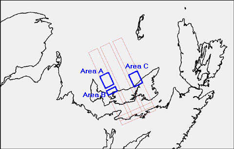
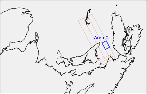
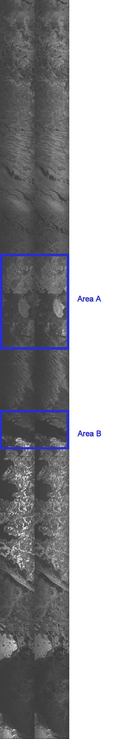
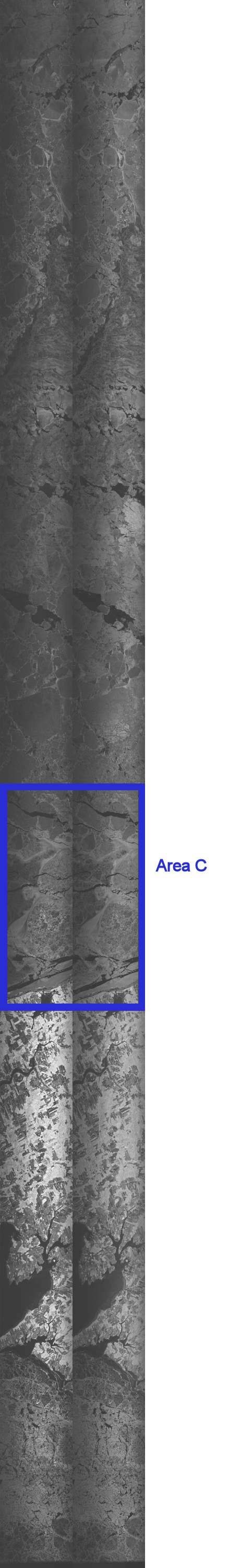
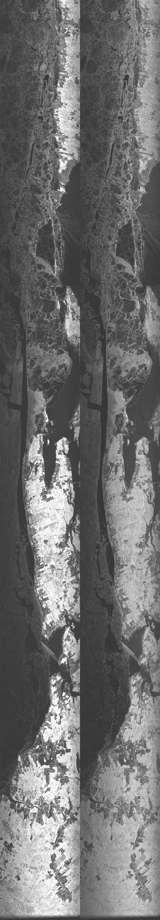
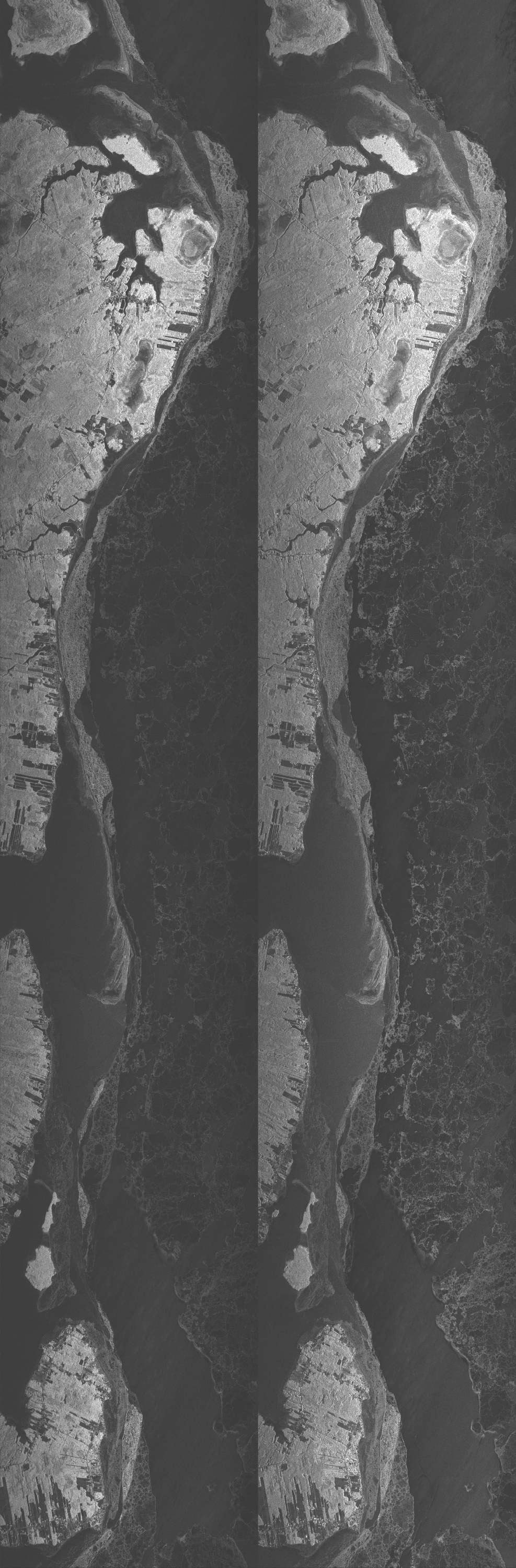
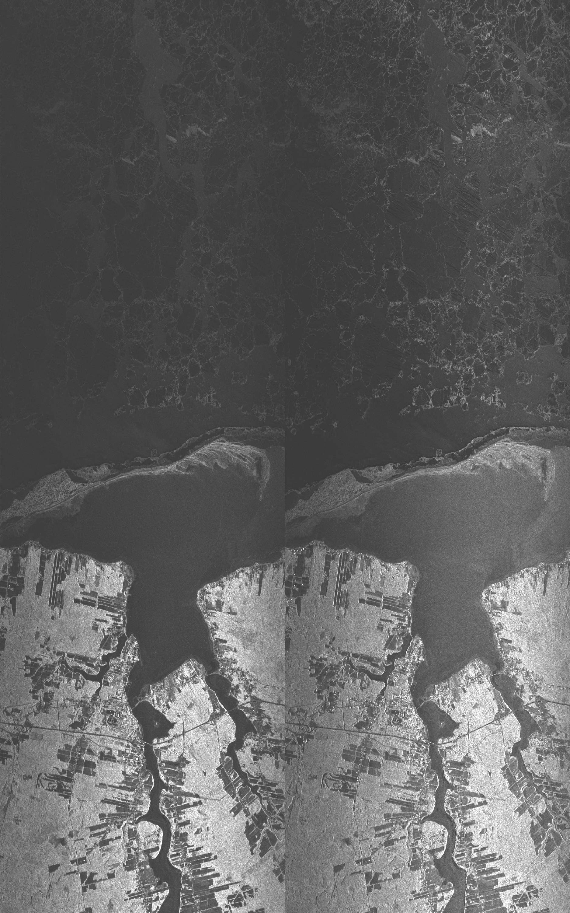
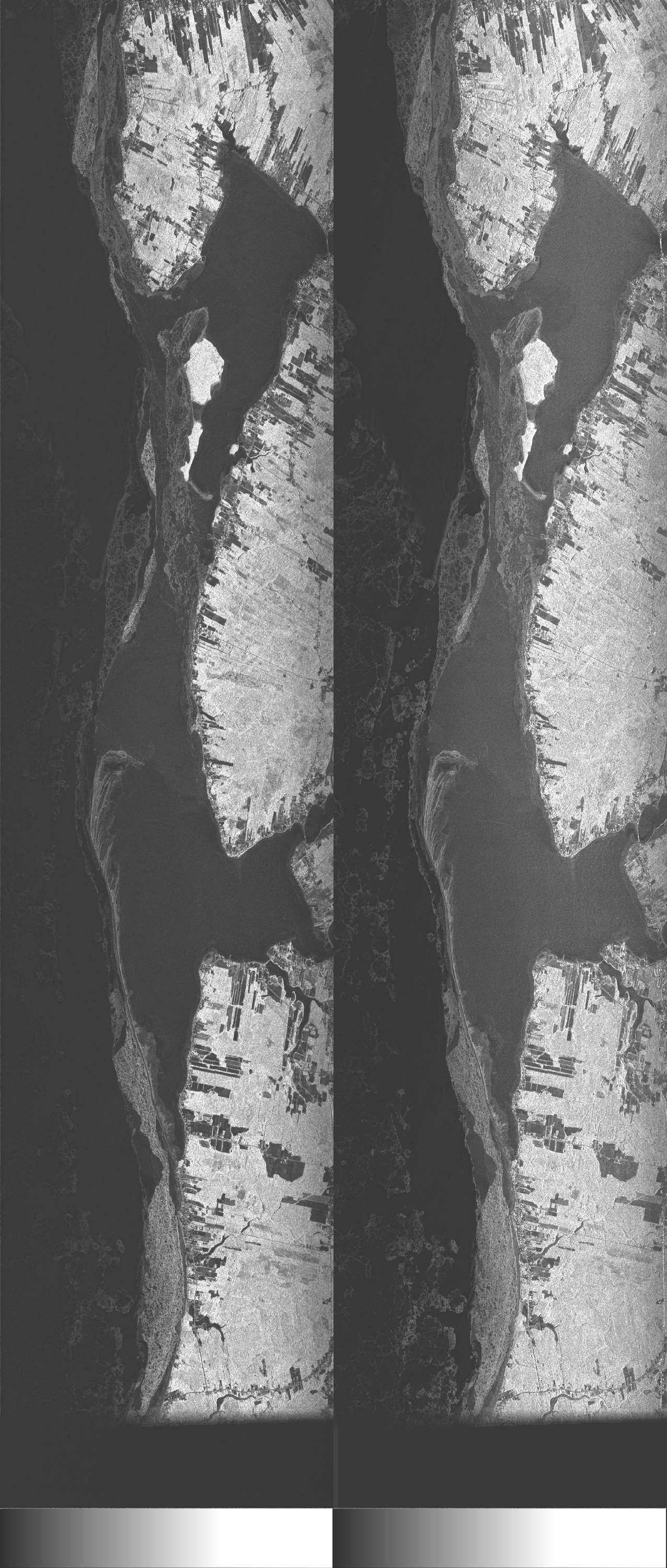
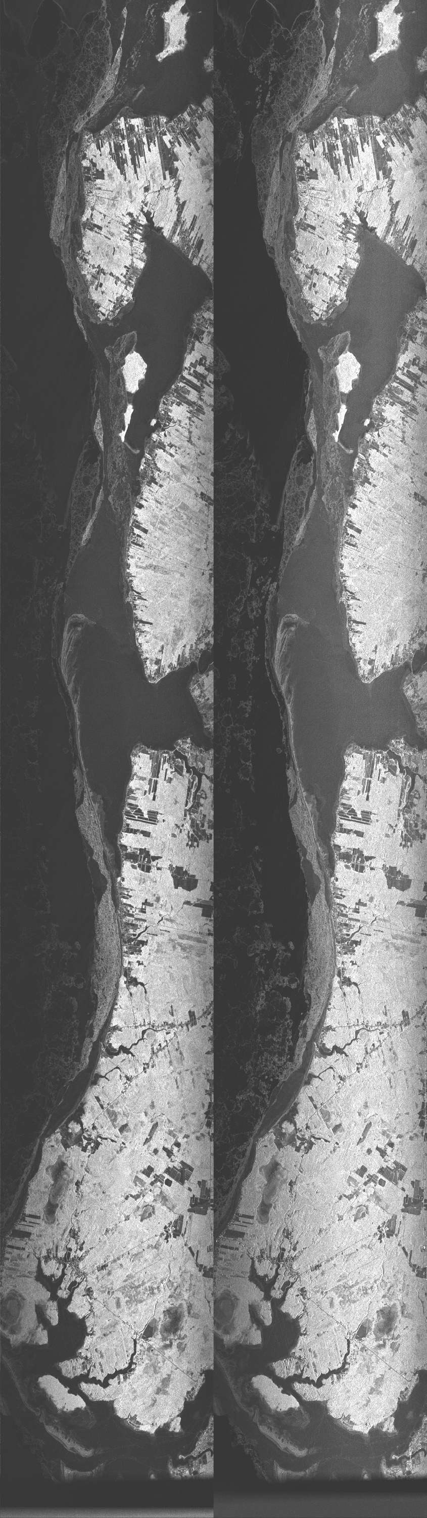
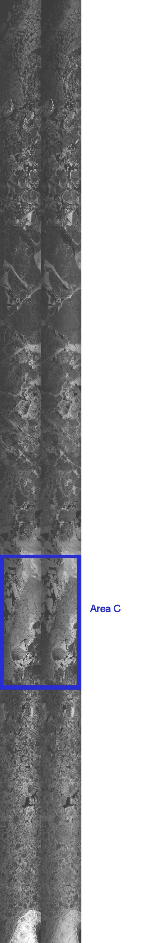
The Convair-580 aircraft was flown on three days during the project period; March 1st, March 2nd and March 5th. It should be noted that the flight on March 2nd was not flown in support of this project. Each day's flight consisted of 4 lines and the spatial coverage maps for March 1st and 5th are included below in Figures 3.2.1 and 3.2.2. Fully polarimetric data is available for those portions of the swaths denoted as Areas A, B & C on Figure 3.2.1, and Area C on Figure 3.2.2.
Back to Table of Contents3.2.2 Aircraft Description
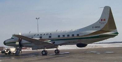
The Convair-580 is a fully equipped, versatile platform for remote sensing. The aircraft is owned and operated by Environment Canada. The Convair-580 operates a C/X-SAR system which is an airborne synthetic aperture radar (SAR), developed by the Canada Centre for Remote Sensing. The aircraft is equipped with a C- and X-band SAR, each with dual-channel receivers. It has simultaneous C-band imaging at up to four polarization combinations. The SAR transmits in either horizontal or vertical polarization with reception at horizontal and vertical polarization simultaneously.
The radar is normally operated in one of three geometries, or modes, known as nadir, narrow swath, and wide swath. However, for special applications, the radar is capable of greater flexibility: The starting incidence angle can be changed by varying the range gate delay, so that any swath location can be chosen, relative to the aircraft position. The aircraft's operating altitude is variable but about 6.5 km (21 000 ft) is optimum. At this altitude, the high-resolution (6 m x 6 m) real-time imagery can be generated over incidence angles from 0° to 74° (as nadir mode), or 45° to 76° (as narrow swath mode). Lower resolution (20 m x 10 m) imagery can be obtained over a wide swath of about 63 km, with incidence angles varying from 45° to 85°, to maximize the area of coverage.
For this project, the pixel size of the Convair 580 aircraft data is 4 m by 4 m, so a resolution of 8 metres. The projection has been converted to ground range, so therefore all pixels from the near to far range are equal.
The aircraft records the raw 16-bit complex signal data to helical scan tape during acquisition. During flight the real time processor on the CV-580 produces a detected low-resolution image. This 8 bit image domain RTP data is stored to exabyte which can then be read and combined into PCI ".pix" file or as tagged image file format ".tif". It was these low-resolution images that were processed into ERDAS Imagine format (IMG) by project personnel in the field. The CIS received an intermediary file format which its systems processed into the same ERDAS format (IMG). The signal data is then processed and can be outputted to three different formats:
- SIR-C format
- Magnitude
- Relative Phase
3.2.3 Data Format
Data for this project was archived in 4 formats:
- Low-resolution intermediary format (b*)
- ERDAS Imagine native format (IMG)
- Georefenced Tagged Image File Format (GeoTIFF)
- Quicklook JPEG (JPG)
- SIR-C georeferenced and SLC fully polarimetric data
It should be noted that not all of these formats are available for all lines of CV-580 data. Because, data for March 2nd was not acquired in support of the Envisat validation project, processed files were not created. All data collected in support of this project is listed in Table 3.2.1. Digital Arc-Info coverages exist for each of the 2 CV-580 flight paths. These files will provide users the ability to overlay the footprint of the flights onto other data sets within a GIS/Image Analysis software. Flight direction can be determined from the Flight Path maps in Appendix A.
Please refer to Appendix A which contains detailed Flight information and Data Tracking forms for each flight.
 Back to Introduction
 Back to Introduction
| Date | Time (Z) | Line # | Intermediary format | IMG | GeoTIFF | JPG |
|---|---|---|---|---|---|---|
| 3/1/2003 | 14:56 -15:21 | 1 | F20030301100209L01.b03.zip | mar01_line1-sub2.img | mar01_l1p1.tif | f20030301100209l01.jpg |
| 3/1/2003 | 15:32 -15:55 | 2 | F20030301103624L02.b03.zip | mar01_line2-sub2.img | mar01_l2p2.tif | f20030301103624l02.jpg |
| 3/1/2003 | 16:04 -16:28 | 3 | F20030301110952L03.b03.zip | mar01_line3_sub2.img | mar01_l3p3_new.tif | f20030301110952l03.jpg |
| 3/1/2003 | 16:40 -16:56 | 4 | F20030301114651L04.b03.zip | mar01_line4.img | mar01_l4p4.tif | f20030301114651l04.jpg |
| 3/2/2003 | 14:17 -14:25 | 1 | F20030302092230L01.b04 | f20030302092230l01.jpg | ||
| 3/2/2003 | 14:38 -14:44 | 2 | F20030302094351L02.b04 | f20030302094351l02.jpg | ||
| 3/2/2003 | 14:56 -15:03 | 3 | F20030302100153L03.b04 | f20030302100153l03.jpg | ||
| 3/2/2003 | 15:23 -15:31 | 4 | F20030302102753L04.b04 | f20030302102753l04.jpg | ||
| 3/5/2003 | 14:10 -14:35 | 1 | F20030305091515L02.b04.zip | mar05_580-1stack.img | mar05_l1p1.tif | f20030305091515l02.jpg |
| 3/5/2003 | 14:48 -15:13 | 2 | F20030305095342L03.b04.zip | mar05_580-2stack.img | mar05_l2p2.tif | f20030305095342l03.jpg |
| 3/5/2003 | 15:25 -15:51 | 3 | F20030305102920L04.b04.zip | mar05_580-3stack.img | mar05_l3p3.tif | f20030305102920l04.jpg |
| 3/5/2003 | 16:08 -16:09 | 4 | F20030305111225L05.b04.zip | mar05_580-4stack.img | mar05_l4p4.tif | f20030305111225l05.jpg |